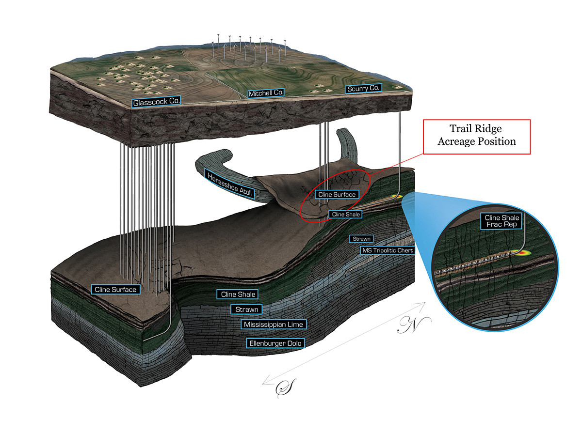
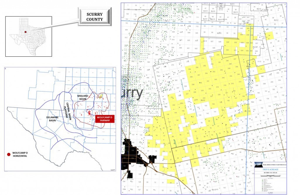
Trail Ridge’s acreage position in Scurry County, Texas is located along the eastern margin of the Midland Basin, immediately adjacent to the Eastern Shelf, which forms the eastern boundary of the acreage. To the west, the acreage area is bounded by the northeast limb of the Horseshoe Atoll. The acreage is located along the axis of a sub-basin located between these two areas, which was fed large volumes of siliciclastic and carbonate debris through Permo-Penn time. The company’s production/exploration fairway is about 10 miles wide and 20 miles long. The company commenced operations in Scurry County, Texas in 2013 on its 70,000 contiguous net acres targeting Wolfcamp D and Mississippian Lime and has drilled 3 wells (2 operated) on its Midland Basin Scurry County assets which have proved the presence of commercial hydrocarbon recovery in the area.
- 78,500 gross / 70,000 net acres in Scurry County
- 3 producing (2 operated) Wolfcamp D wells
- Over 350 net identified 7,500’ lateral Wolfcamp D locations and several 3-D seismic based Wolfcampian/Strawn/Mississippian/Ellenburger prospects
- Additional upside in conventional Canyon Reef prospect with over 3 MMBOE of recoverable resource potential directly analogous to the Kelly-Snyder field
- Trail Ridge has conducted extensive geologic, reservoir, and core analyses on the Wolfcamp D
- Initial test wells have served to identify completion techniques which are expected to result in wells with over 500 MBOE EURs and single-well IRRs of greater than 40%
Wolfcamp D Geological Model